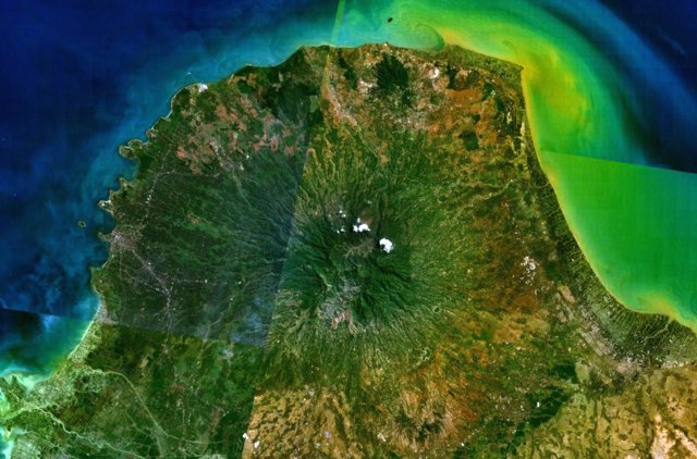
קובץ:Gunung Muria.jpg
Gunung_Muria.jpg (640 × 422 פיקסלים, גודל הקובץ: 67 ק"ב, סוג MIME: image/jpeg)
היסטוריית הקובץ
ניתן ללחוץ על תאריך/שעה כדי לראות את הקובץ כפי שנראה באותו זמן.
| תאריך/שעה | תמונה ממוזערת | ממדים | משתמש | הערה | |
|---|---|---|---|---|---|
| נוכחית | 13:55, 27 ביולי 2010 |  | 422 × 640 (67 ק"ב) | Michael Metzger | {{Information |Description={{en|1=Muria stratovolcano forms the broad Muria Peninsula along the northern coast of central Java in this NASA Landsat mosaic (with north to the top). This 1625-m-high volcano lies well north of the main volcanic chain in Java |
שימוש בקובץ
הדפים הבאים משתמשים בקובץ הזה:
שימוש גלובלי בקובץ
אתרי הוויקי השונים הבאים משתמשים בקובץ זה:
- שימוש באתר arz.wiki.x.io
- שימוש באתר ceb.wiki.x.io
- שימוש באתר cs.wiki.x.io
- שימוש באתר de.wiki.x.io
- שימוש באתר en.wiki.x.io
- שימוש באתר en.wikivoyage.org
- שימוש באתר eu.wiki.x.io
- שימוש באתר fr.wiki.x.io
- שימוש באתר id.wiki.x.io
- שימוש באתר lld.wiki.x.io
- שימוש באתר nl.wiki.x.io
- שימוש באתר pl.wiki.x.io
- שימוש באתר pt.wiki.x.io
- שימוש באתר ru.wiki.x.io
- שימוש באתר sk.wiki.x.io
- שימוש באתר sv.wiki.x.io
- שימוש באתר www.wikidata.org

