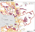
קובץ:Jerusalem-barrier June 2007-OCHAoPt.jpeg

גודל התצוגה המקדימה הזאת: 636 × 599 פיקסלים. רזולוציות אחרות: 255 × 240 פיקסלים | 509 × 480 פיקסלים | 815 × 768 פיקסלים | 1,159 × 1,092 פיקסלים.
לקובץ המקורי (1,159 × 1,092 פיקסלים, גודל הקובץ: 190 ק"ב, סוג MIME: image/jpeg)
היסטוריית הקובץ
ניתן ללחוץ על תאריך/שעה כדי לראות את הקובץ כפי שנראה באותו זמן.
| תאריך/שעה | תמונה ממוזערת | ממדים | משתמש | הערה | |
|---|---|---|---|---|---|
| נוכחית | 11:46, 2 ביולי 2013 |  | 1,092 × 1,159 (190 ק"ב) | Wickey-nl | User created page with UploadWizard |
שימוש בקובץ
הדף הבא משתמש בקובץ הזה:
שימוש גלובלי בקובץ
אתרי הוויקי השונים הבאים משתמשים בקובץ זה:
- שימוש באתר bn.wiki.x.io
- שימוש באתר el.wiki.x.io
- שימוש באתר en.wiki.x.io
- שימוש באתר eo.wiki.x.io
- שימוש באתר fr.wiki.x.io
- שימוש באתר fy.wiki.x.io
- שימוש באתר nl.wiki.x.io
- שימוש באתר pt.wiki.x.io
- שימוש באתר ru.wiki.x.io
- שימוש באתר tr.wiki.x.io
- שימוש באתר uk.wiki.x.io
- שימוש באתר zh.wiki.x.io
